
Lake & Watershed Information
Lake & Watershed Information
- Boating
- Source Protection
- Source Water Assessment & Protection (SWAP Report)
- Wetlands & Your Water Supply
- Protect Your Lake from Nonpoint Pollution
- Reporting Illegal Dumping or Suspicious Activity
- Water Facts & Tidbits
- Zebra Mussel Information
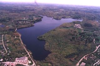
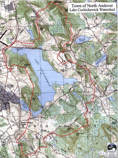
A watershed consists of all the land that contributes water to a body of water. To outline watershed boundaries, connect the points of highest elevation around a lake on a topographic map. Water falling within this bowl flows by gravity in streams and groundwater to the lake.
A watershed can extend for miles. So, lake protection must extend to the entire watershed.
Picture a drop of rainwater landing in your yard three miles from a lake. It washes into the driveway and down to the roadside ditch where it flows into a culvert under the road, which then empties into a stream that feeds the lake.
That drop of water might contain lawn fertilizer, motor oil from the road, cow manure from the farm downstream, or dirt from the new development across the street. It all ends up in the lake.
On the Map below the Red Line shows you our Watershed
We want to make sure that Lake Cochichewick and the trails around it are enjoyed by all so please remember to pick up after yourself, your dogs, and follow the town bylaws. Keeping the lake clean and free of trash, pet waste, and any other wastes ensures safe, clean drinking water for the residents.